- Remove Small landforms filter Small landforms
- Remove Boat- and shipyards filter Boat- and shipyards
- Remove Basement rocks filter Basement rocks
- Remove Nordhordland filter Nordhordland
- Remove Quarries filter Quarries
- Remove Chieftains and royal lines filter Chieftains and royal lines
- Remove Fisheries filter Fisheries
- Remove Road constructions filter Road constructions


Seim
Sæheim (Seim) at Lygrefjord is mentioned as one of the royal farms of Harald Hårfagre. Several of the first Norwegian national kings had their seat here, and the farm became Crown Property up to the 1400s. According to the sagas, Håkon den gode is buried on the farm.

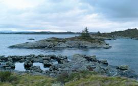
Håøy
Håøy lies centrally in one of the main shipping lanes going into Bergen --- with Håyøsund on the south side facing Meland, and Hagelsundet facing Lindåslandet. Names like Nordfarskista and Nordfarsskorane explain things. The strategic position was important in Viking times and it has been important in our days too. The beacon on Håøy can have been built in the establishment of the coastal administration in Håkon the Good’s time, about 950 AD. The defence structure of which we say remains on Håøy Summit held a critical position during Norwegian neutrality during the First World War. The defence structure was taken down in 1957.

Salhusfjorden
When the debate about building a pontoon bridge over Salhus Fjord was raging, some were afraid that the bridge would disrupt the ecology of the fjord system inside. The worst predictions did not prove true, but it is easy to see that there was a change: the Puffins have gotten a new food platter after the Nordhordaland bridge was built. Its favourite meal, mussels, thrive on the pontoons that are the foundation for the bridge.


Fosnstraumen
At the southern end of the bridge between Radøy and Fosnøy archaeologists found an unusual Stone Age settlement. There was a thick “cultural layer” here with the remains of the waste dumps of a hunting people. The place was called Kotedalen. Here they came, one group after the other, and settled for some weeks, some months, or maybe years before they went on, leaving the settlement deserted. Time after time it happened. At least 16 settlement phases have been identified, stretching over 5,500 years.

Kolåseidet
The little cowshed which lies on the fence at Kolåseidet, constructed in connection with the stone fence, has put its mark on the cultural landscape. On the border between the home fields and the forest, the cowshed is the very symbol of a simple resource management - the division between the cropland and the grazing grounds. And the way it was built has its roots far back in time.

Dalseid- Eidslandet road construction

