- Remove Small landforms filter Small landforms
- Remove Road constructions filter Road constructions
- Remove Middle age filter Middle age
- Remove Maritime environments filter Maritime environments
- Remove Livelihood and Craftsmanship filter Livelihood and Craftsmanship
- Remove Place filter Place
- Remove Factories filter Factories
- Remove Conservation area filter Conservation area
- Remove Quarns and mills filter Quarns and mills
- Remove Wildlife filter Wildlife
- Remove Archaeology filter Archaeology
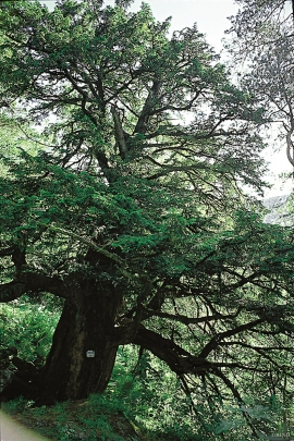
Holmedalsberget
If you want to be on your own for a long day in a magnificent deciduous forest in demanding terrain, then HOLMESDALSBERGET is the right place. This is a big forested area by Matres Fjord in the southwestly part of Kinnherad. Here, we find one of the largest deciduous forests in Hordaland. The forest stretches over several kilometres.

Sandviken
Close to the tunnel opening at Amalie Skrams vei in Ssandviken, there is a cultural monument of European dimensions; a rope making works that produced rope and fishing tackle for West and North Norway.

Verftet
Today the name “Verftet” is linked to both a district and conglomeration of buildings lying protected by Fredriksberg castle. The original shipyard was founded in the 1780s by Georg Brunchorst and Georg Vedeler. It was called Gerogenes Verft (the shipyards of the Georgs), and here ships were both built and repaired in the years after 1786.

Bjoreidalen
Bjoreidalen is one of the classic bird localities on Hardangervidda. It is especially known for its wading birds, with as many as 17 of the 19 wader species that nest in Hordaland.

Halne
At Halnefjorden, a few hundred metres east of Halne mountain lodge, lie the remains of two stone sheds – Halnelægeret. Some generations ago the cattle drovers stopped here in the summer; they were the cowboys of their time. But Halnelægeret already had a long history before the cattle drovers came.

Langavassmyrane
The Ruff lek on Langvassmyrane is the only known phenomenon of its kind on Hardangervidda. Every year it attracts hens from the whole plateau. The marsh is also the richest wetland in the county. This green oasis is located in a rocky moraine landscape a few hours walking distance south of Dyranut.

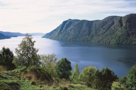
Granvinsvassdraget
After the ice age, Granvin Fjord reached all the way up under Skjervsfjossen waterfall. Just a thousand years later, as a result of the rising of the land after the ice melted, this whole inner part of the fjord freed itself of the sea and became Granvinsvatnet lake. In spite of this rise in elevation, this waterway is still navigable for fish: Sea trout have wandered into Granvinsvatnet in more recent times and evolved to become freshwater trout. And salmon and sea trout made the journey 13 kilometres up the Storelvi river.


