Published: 28.07.2015 | Author: Kåre Utaaker
COLD DEPRESSION
If you drive between Søfteland and Ulven on a clear spring morning, or an evening in late autumn, you are advised to be careful on the turns. The temperature on the road can fall to under 0 °C here long before other places in the municipality. On clear, still nights the earth's surface chills quite a bit. In exposed areas a layer of cold air develops very near the ground and the road surface can easily chill to below freezing.
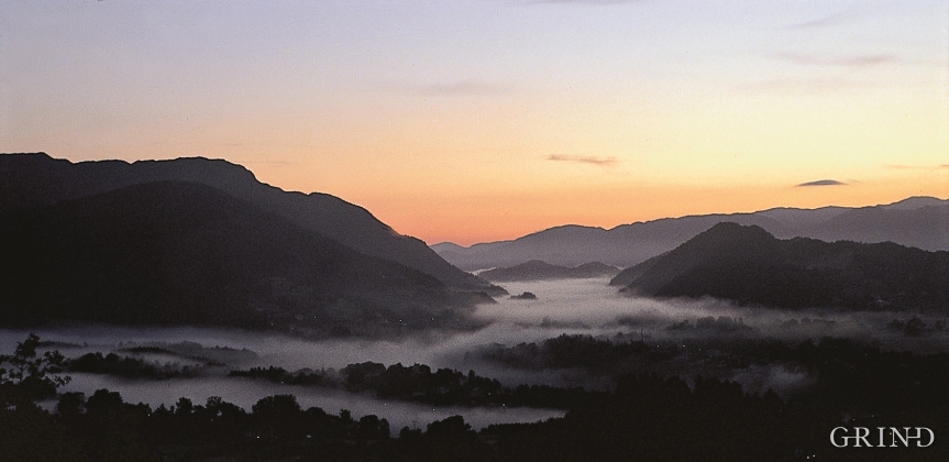
On cloudless, windless nights in winter, when the lake surface is frozen, it can be exceptionally cold. The heavy, cold air that slowly descends toward the ground gets trapped between the higher areas, buildings and forest. Over the low-lying area along the stretch from Søfteland to Ulven and Tøsdal a "sea of cold air" is formed - an inversion - with the lowest temperatures near the ground, and increasing upwards (see frame). In severe cold spells the temperatures near the ground fall to under –25 °C in the biggest depressions.
Higher up in the air layer, at perhaps 100 m above the surface, a current of air moves slowly toward Osøyro and Bjørnefjorden. Its speed increases toward the fjord. Turbulence in the air masses and warmth from traffic and houses weaken the inversion in the more built up areas at Osøyro, so that the temperature here is seldom lower than about -12 °C. Since there is a little wind at Øyro the cold can still feel as biting as in the stiller, gentler colder air at Søfteland.
This pattern of local minimum temperatures occurs on cold, still nights in all seasons, though in the short summer nights the contrasts are not as noticeable. On fine summer days, however, the cold depressions at Søfteland tend to be several degrees warmer than at the beach areas in Os.
Unusually low temperatures can occur other places in Hordaland when conditions are right, too, but the phenomenon is best documented at Søfteland.
Schematic vertical section of cold air accumulating on still, clear winter nights, seen in a cross-section from Sælehaugen to Osøyro. Dark blue colour means very cold and strong inversion. Lighter colours with increasing temperature upwards in the cold air layer.
Inversion
Normally the temperature falls with increasing altitude, on average 0,6 to 1 degree C per 100m. Cold air is heavier than warm air, and therefore there tends to be a vertical mixing of air masses. On still, clear nights the cooling can be pronounced - especially near the ground. Then. temperature conditions can be the opposite of normal; that is, the temperature instead increases with altitude. This is what is called a "temperature inversion". The coldest and heaviest air is nearest the ground, and therefore there will not be any vertical mixing.
- Kolderup, C. F. 1907. Bergensfeltene og tilstøtende trakter i senglacial og postglacial tid. Bergen Museums Årbok 1907:14.


